-
First Page
- About
- District Administration
- Local Government
-
Govt. Offices
Education and Culture
-
Tourism Motel, Bangladesh Tourism Corporation, Rangpur
-
District Sports Office
-
Office of the Deputy Director, Secondary and Higher Secondary
-
District Education Office, Rangpur
-
District Mass Education Bureau
-
District Primary Education Office
-
Islamic Foundation, Rangpur
-
District Government Public Library
-
Rangpur Museum
-
Bangladesh Shishu Academy
-
Textile vocational institute, Rangpur
-
Govt. Teachers Training College
-
Primary Teachers\' Training Institute(PTI), Rangpur
-
District Shilpakala Academy, Rangpur
Human resource development
-
City Social Service Office, Rangpur
-
Government Children\'s Family (Boy)
-
Government Children\'s Family (Girls), Rangpur
-
Socio-economic center
-
Rural Poverty Alleviation Foundation
-
District Employment and Manpower Office
-
Technical Training Center
-
Office of the Deputy Director, Department of Women Affairs, Rangpur
-
District Cooperative Office
-
District Social Service Office, Rangpur
-
Bangladesh Rural Development Board
-
Department of Youth Development
-
Protibondhi Seba O Shahajyo Kendro,Rangpur
-
National Women\'s Organization, Rangpur
-
Amar Bari Amar Khamar Project,Palli Sanchay Bank, Rangpur
-
Cooperative Zonal Institute, Rangpur
-
Integrated Visually Impaired Educational Institute, Rangpur
-
Office of Probation Officer, Rangpur
Communicaton and Information Technology
-
□ Department of Information and Communication Technology, District Office
-
□ Bangladesh Postal Department, Rangpur
-
□ Bangladesh Computer Council (BCC), Regional Office, Rangpur
-
□ District Information Office, Rangpur
-
□ Bangladesh Television, Rangpur Subcentre
-
□ Weather, radar and seismic observatories
Engineering and Communication
-
□ Department of Local Government Engineering
-
□ Office of the Executive Engineer, Roads Department
-
□ Office of the Executive Engineer, Department of Education Engineering
-
□ Department of Education Engineering (Asst. Engineer)
-
□ Chief Engineer, Distribution Zone
-
Sales & Distribution Division-2, NESCO PLC, Rangpur
-
BRTA Office
-
□ Rangpur Palli Bidyut Samiti-2
-
□ Palli Bidyut Samiti-1
-
□ Department of Public Works
-
□ BTCL,Rangpur
-
Bangladesh Water Development Board
-
Office of the Executive Engineer, Bangladesh Rural Electrification Board, Rangpur
-
Superintending Engineer, Rangpur PWD Circle
-
Office of the Executive Engineer, Health Engineering Department (HED)
Other Offices
-
□ District Statistics Office
-
Rangpur Mohanagar Revenue Circle Land Offie
-
□ Anti-Corruption Commission, Integrated District Office
-
□ Office of the Commissioner of Taxes
-
□ Department of Customs, Excise and VAT
-
□ National Department of Consumer Protection
-
Small Farmer Development Foundation, Regional Office, Rangpur
-
□ Zonal Settlement Office
-
□ Office of the District Registrar
-
□ Passport and visa office
-
BSIC District Office, Rangpur
-
□ District Savings Office / Bureau
-
□ District Election Office
-
House Building Finance Corporation
-
□ Cantonment Board, Rangpur Cantonment
-
Rural Development Academy, Rangpur
-
□ Bangladesh Bank, Rangpur
-
□ Cluster village (CVRP) project
-
□ Department of Inspection of Offices, Factories and Establishments of Deputy Inspector General
-
□ BSTI, Rangpur
-
Regional Labour Office,Rangpur
-
□ Office of the Assistant Controller of Imports and Exports
-
Department of Environment
-
Bangladesh Food Safety Authority, District Office, Rangpur
-
General Insurance Corporation
-
Life Insurance Corporation
Agriculture and Food
-
Department of Agricultural Extension
-
District Livestock Department
-
District Fisheries Officer\'s Office, Rangpur
-
DEPUTY DIRECTOR, SEED PRODUCTION CENTER, BADC, RANGPUR
-
Office of the Joint Director (Fertilizer), BADC, Rangpur Region, Rangpur.
-
Joint Director (SPC), BADC, Rangpur
-
District Office, Water Resources Planning Organization, Rangpur
-
District Food Control\'s Office
-
Agricultural Training Institute, Tajhat, Rangpur
-
Barendra Multi Development Association (BMDA)
-
Jute Research Institute, Regional Office
-
Office of Senior Agricultural Marketing Officer, Rangpur
-
Assistant Engineer, BADC
-
Atomic Agriculture Research Institute
-
Irrigation Wing (Construction), BADC
-
Office of the Deputy Director (Seed Marketing) BADC
-
Divisional Forest Officer\'s Office
-
Soil Resources Development Institute
-
District Artificial Insemination Center, Rangpur
-
Bangladesh Rice Research Institute
-
Assistant Engineer (Construction), BADC, Rangpur
-
Agricultural Information Service
-
Department of Jute, Rangpur Region, Rangpur
-
District Seed Cretifing Authority
-
Drro Office
-
Small Farmer Development Foundation, Regional Office, Rangpur
-
Horticulture Center, Burirhat, Rangpur
-
Office of the Chief Cotton Development Officer,Cotton Development Office,Rangpur
-
Metropolitan Agriculture Office,Tajhat,Rangpur
-
Rangpur Textile Institute, Department OF Textile (DOT)
-
Regional Scriculture Extention Office, Rangpur
-
Cotton Research Center, Rangpur
-
Regional Agricultural Research Station, Burirhat, Rangpur
-
Tourism Motel, Bangladesh Tourism Corporation, Rangpur
-
Other Organization
- e-Services
- Gallery
-
First Page
-
About
District Introduction
History and Tradition
Geography and Economics
-
District Administration
Deputy Commissioner
Deputy Commissioner\'s Office
DDLG/ADC
Officers and Employees
Important Information
Local Government Section
-
Local Government
Rangpur City Corporation
Zila Parishad, Rangpur
-
Govt. Offices
Law-Discipline and Security
Education and Culture
- Tourism Motel, Bangladesh Tourism Corporation, Rangpur
- District Sports Office
- Office of the Deputy Director, Secondary and Higher Secondary
- District Education Office, Rangpur
- District Mass Education Bureau
- District Primary Education Office
- Islamic Foundation, Rangpur
- District Government Public Library
- Rangpur Museum
- Bangladesh Shishu Academy
- Textile vocational institute, Rangpur
- Govt. Teachers Training College
- Primary Teachers\' Training Institute(PTI), Rangpur
- District Shilpakala Academy, Rangpur
Human resource development
- City Social Service Office, Rangpur
- Government Children\'s Family (Boy)
- Government Children\'s Family (Girls), Rangpur
- Socio-economic center
- Rural Poverty Alleviation Foundation
- District Employment and Manpower Office
- Technical Training Center
- Office of the Deputy Director, Department of Women Affairs, Rangpur
- District Cooperative Office
- District Social Service Office, Rangpur
- Bangladesh Rural Development Board
- Department of Youth Development
- Protibondhi Seba O Shahajyo Kendro,Rangpur
- National Women\'s Organization, Rangpur
- Amar Bari Amar Khamar Project,Palli Sanchay Bank, Rangpur
- Cooperative Zonal Institute, Rangpur
- Integrated Visually Impaired Educational Institute, Rangpur
- Office of Probation Officer, Rangpur
Health
Communicaton and Information Technology
- □ Department of Information and Communication Technology, District Office
- □ Bangladesh Postal Department, Rangpur
- □ Bangladesh Computer Council (BCC), Regional Office, Rangpur
- □ District Information Office, Rangpur
- □ Bangladesh Television, Rangpur Subcentre
- □ Weather, radar and seismic observatories
Engineering and Communication
- □ Department of Local Government Engineering
- □ Office of the Executive Engineer, Roads Department
- □ Office of the Executive Engineer, Department of Education Engineering
- □ Department of Education Engineering (Asst. Engineer)
- □ Chief Engineer, Distribution Zone
- Sales & Distribution Division-2, NESCO PLC, Rangpur
- BRTA Office
- □ Rangpur Palli Bidyut Samiti-2
- □ Palli Bidyut Samiti-1
- □ Department of Public Works
- □ BTCL,Rangpur
- Bangladesh Water Development Board
- Office of the Executive Engineer, Bangladesh Rural Electrification Board, Rangpur
- Superintending Engineer, Rangpur PWD Circle
- Office of the Executive Engineer, Health Engineering Department (HED)
Other Offices
- □ District Statistics Office
- Rangpur Mohanagar Revenue Circle Land Offie
- □ Anti-Corruption Commission, Integrated District Office
- □ Office of the Commissioner of Taxes
- □ Department of Customs, Excise and VAT
- □ National Department of Consumer Protection
- Small Farmer Development Foundation, Regional Office, Rangpur
- □ Zonal Settlement Office
- □ Office of the District Registrar
- □ Passport and visa office
- BSIC District Office, Rangpur
- □ District Savings Office / Bureau
- □ District Election Office
- House Building Finance Corporation
- □ Cantonment Board, Rangpur Cantonment
- Rural Development Academy, Rangpur
- □ Bangladesh Bank, Rangpur
- □ Cluster village (CVRP) project
- □ Department of Inspection of Offices, Factories and Establishments of Deputy Inspector General
- □ BSTI, Rangpur
- Regional Labour Office,Rangpur
- □ Office of the Assistant Controller of Imports and Exports
- Department of Environment
- Bangladesh Food Safety Authority, District Office, Rangpur
- General Insurance Corporation
- Life Insurance Corporation
Agriculture and Food
- Department of Agricultural Extension
- District Livestock Department
- District Fisheries Officer\'s Office, Rangpur
- DEPUTY DIRECTOR, SEED PRODUCTION CENTER, BADC, RANGPUR
- Office of the Joint Director (Fertilizer), BADC, Rangpur Region, Rangpur.
- Joint Director (SPC), BADC, Rangpur
- District Office, Water Resources Planning Organization, Rangpur
- District Food Control\'s Office
- Agricultural Training Institute, Tajhat, Rangpur
- Barendra Multi Development Association (BMDA)
- Jute Research Institute, Regional Office
- Office of Senior Agricultural Marketing Officer, Rangpur
- Assistant Engineer, BADC
- Atomic Agriculture Research Institute
- Irrigation Wing (Construction), BADC
- Office of the Deputy Director (Seed Marketing) BADC
- Divisional Forest Officer\'s Office
- Soil Resources Development Institute
- District Artificial Insemination Center, Rangpur
- Bangladesh Rice Research Institute
- Assistant Engineer (Construction), BADC, Rangpur
- Agricultural Information Service
- Department of Jute, Rangpur Region, Rangpur
- District Seed Cretifing Authority
- Drro Office
- Small Farmer Development Foundation, Regional Office, Rangpur
- Horticulture Center, Burirhat, Rangpur
- Office of the Chief Cotton Development Officer,Cotton Development Office,Rangpur
- Metropolitan Agriculture Office,Tajhat,Rangpur
- Rangpur Textile Institute, Department OF Textile (DOT)
- Regional Scriculture Extention Office, Rangpur
- Cotton Research Center, Rangpur
- Regional Agricultural Research Station, Burirhat, Rangpur
-
Other Organization
Educational Institutions
Financial institutions
Organization
Non-governmental organizations
Religious institutions
-
e-Services
District e-service center
National e-service
-
Gallery
Photo Gallery
Videos Gallery

|
1. |
Recognition as a district |
1869. |
|
2. |
Boundaries |
It is bounded by Nilphamari on the North, Gaibandha on the South, Kurigram on the East and Dinajpur district on the West. |
|
3. |
Post code: |
5400 |
|
4. |
Area: |
2400.56 sq km (Upazila based area) |
|
5. |
Weather: |
Average maximum temperature - 32.3 Celsius, average minimum temperature - 11.2 Celsius, average annual rainfall 219.45 mm. |
|
6. |
Administrative Information: |
Upazilas and Thanas - 08 (Rangpur Sadar, Gangachara, Taraganj, Badarganj, Kaunia, Pirgachha, Mithapukur, Pirganj),
|
|
7. |
Population: |
31,69615 (Male – 15,68608 and Female – 16,00067) (as per 2022 census) |
| 8। | Parliamentary seat
|
Total number of seats = 06 |
| 9। | Voter |
2460570 people (Female-1223236, Male-1237311 and Hijra-23) |
|
10। |
Tribe: |
Udao, Pahari, Mushar, Santal, Pahan, Turi etc |
|
11। |
|
University- 01, University College- 03, College- 59, School- 510, Madrasah- 267, Primary School Government- 702, Private- 590. |
|
12। |
Education Rate: |
70.59% (Male 73.34%, Female 67.92%) (as per 2022 census) |
|
13। |
Religious institutions: |
Mosque-5711, Temple-760 and Other Places of Worship |
| 14। | Distance from District Headquarter to Dhaka:
|
370 k:m:
|
| 15। | Distance of upazila head office from district headquarters
|
Sadar- 3 km, Gangachra- 12 km, Taraganj- 30 km, Badarganj- 29 km, |
|
16। |
|
Length of railway line- 62 km, length of National Highway- 84 km
|
|
17। |
Agricultural system: |
Total land area - 2,35,671 ha
|
| 18। | Grain Density:
|
244%
|
|
19। |
Rivers: |
5 (Tista, Yamuneshwari, Ghaghat, Akhira and Karatoa) |
|
20। |
Health System: |
Rangpur Medical College- 1000 beds, Sadar Hospital 50 beds |
|
21। |
Places to visit: |
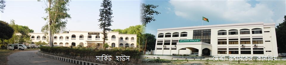
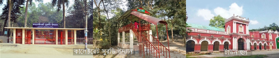
Shrine and Mosque of Hazrat Maulana Keramat Ali Jaunpuri (RA), Tajhat Zamindar House currently used as a museum, Carmichael College Bhawan, Zilla Parishad Bhawan, Binjagat, Shireen Park, Anandnagar, Nine Dome Mosque of Laldighi, Payaraband Zamindar House, Manthanar Zamindar House, Pirgacha Devi Chaudhurani's palace, ItakumariZamindar Shivchandra Roy's Rajbari, Mahiganj's Kazitari Mosque, Rangpur Zoo, Rangpur Town Hall, Rangpur Medical College, Jhar Bishala poet Hayat Mamud's shrine in Pirganj, Kaunia's Anand Math, Benarasi Palli, Nisbetganj other lands of Shataranji industry. |
|
22। |
Industry Related: |
Heavy Industry: Shyampur Sugar Mills, Olive Oil Mill, RK Fan, Dalda Mill, Cigarette Co., Apple Ceramics, Distilleries, Cold Storage, Bidi Factory, Hardboard Mill, Soap Factory, Poultry Farm, Guti Urea Factory.Medium/Small Scale Industries: Mosquito Coil Factory, RFL, PVC Pipe Manufacturing Factory, Food Processing Industry, Textile Industry, Jute & Jute Manufacturing Industry, Printing, Leather Industry, Forestry, Chemical Industry, Engineering.
|


Planning and Implementation: Cabinet Division, A2I, BCC, DoICT and BASIS
Technical Assistance:
![]()
Developed By:
